Features · GeoLake
GeoLake overview
GeoLake is the multimodal lakehouse under the whole platform: one lake for assays, logs, sensors and core photos, queried in plain language or SQL, with answers as auditable SQL and visual reports.

Overview
Geology data ends up in silos: the current program in one database, historical drilling in another, reports and scanned logs as PDFs, and third-party geophysics and spectral data in their own formats. Answering a simple question across them takes days of data crunching.
GeoLake is one multimodal lake for all of it. Capture feeds it, modelling and reporting read from it, and everything updates continuously as new data lands. Ask a question in plain language or SQL and get answers and visual reports.
- Questions in plain language become auditable SQL
- Reports and dashboards
- The AI sees only the schema, never the data
- Works with any customer database; PDFs and scans searchable with OCR
How it works
- 01
One lake, every data type
Assays, logs, sensor readings and core photos in one multimodal lakehouse, across projects.
- 02
Bring in what you already have
Existing databases such as acQuire and migrations, the FastGeo ecosystem, third-party acquisition such as geophysics and spectral, and public data such as government surveys. PDFs and scans become searchable with OCR.
- 03
Ask in plain language
A question in plain language becomes auditable SQL. The AI sees only the schema, never the data.
- 04
Answers and reports
The result comes back as answers, reports and dashboards.
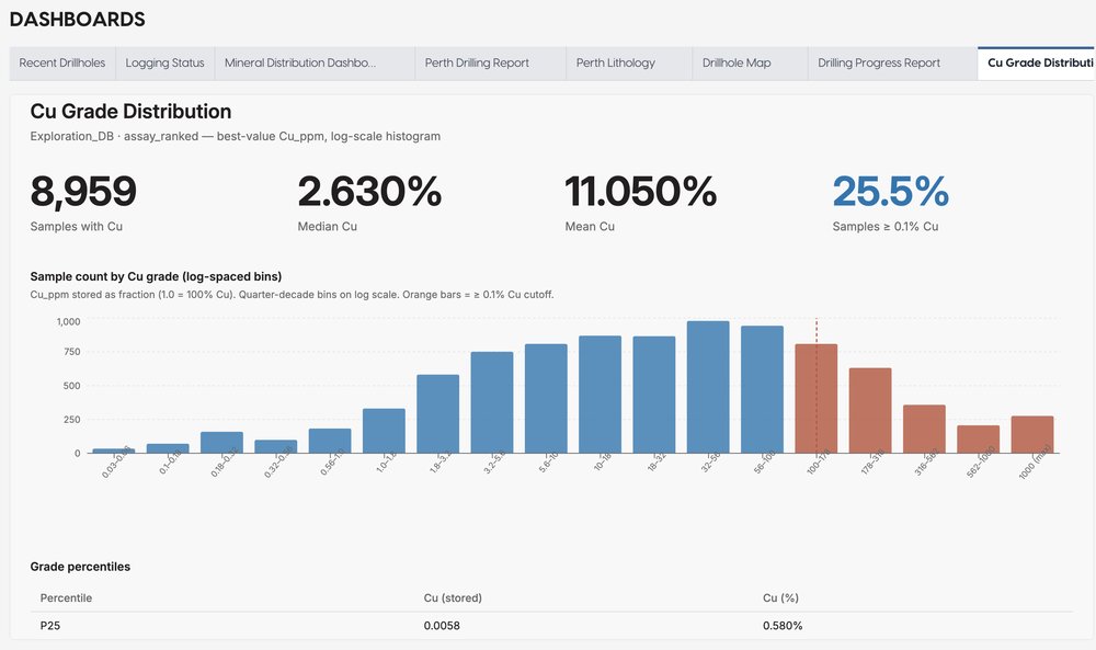
Dashboard from the demo dataset · demo dataset, real screen
Where it fits
GeoLake is the data layer under every step, from the rig to the model.
Next steps
Request access and we’ll email your credentials, then set up your first project on a short onboarding call.