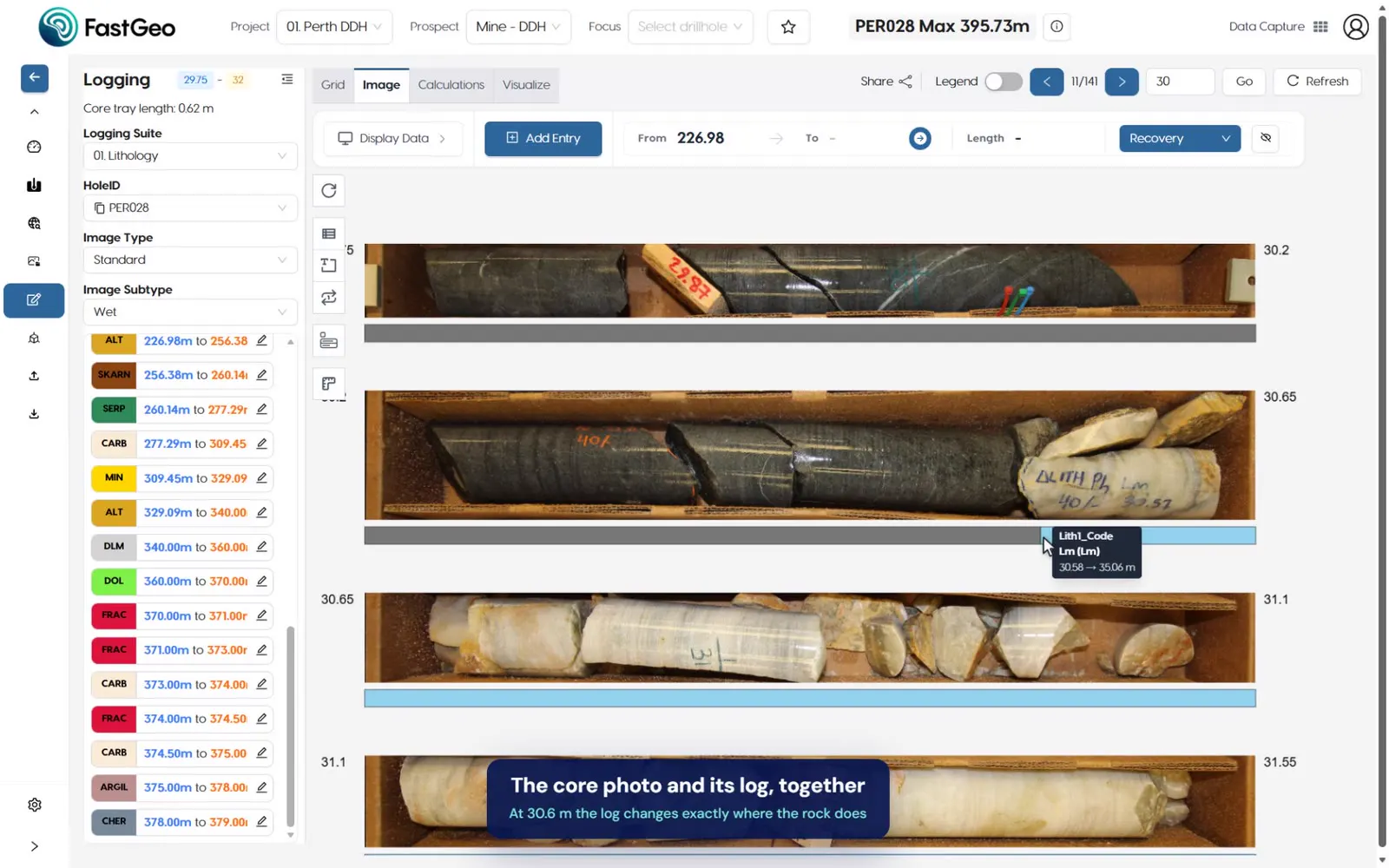
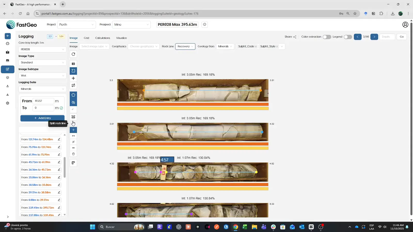
Features · View / Validate
View / Validate overview
A truly multimodal database: all sensor data, logging and assays come together in real time in 2D and 3D, with QA/QC, correlation between holes and advanced reports using MCPs.

Overview
Validating a drilling dataset usually means exporting it piece by piece: the log to one tool, the assays and their standards to a spreadsheet, the photos to a folder. Problems surface late, when the data is already in the model.
FastGeo View / Validate shows everything together, as it is captured: the downhole strip log with its photos and sensor readings, the QA/QC of the assays, the correlation between holes and the 3D model, in one multimodal database.
- Logging, RQD and recovery views
- Correlation between holes
- QA/QC
How it works
- 01
See every dataset at the same depth
Logging, RQD and recovery, photos, sensor readings and assays in one downhole view.
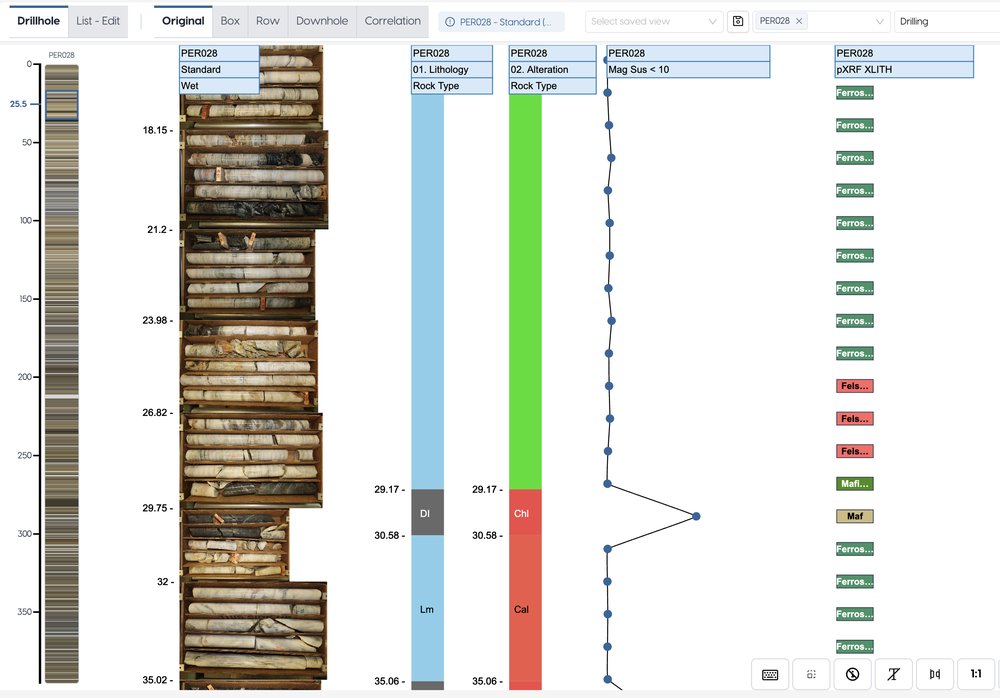
Downhole strip log · demo dataset, real screen - 02
Check the assays as they arrive
QA/QC charts for certified standards and duplicates, so a failing batch is visible before it reaches the model.
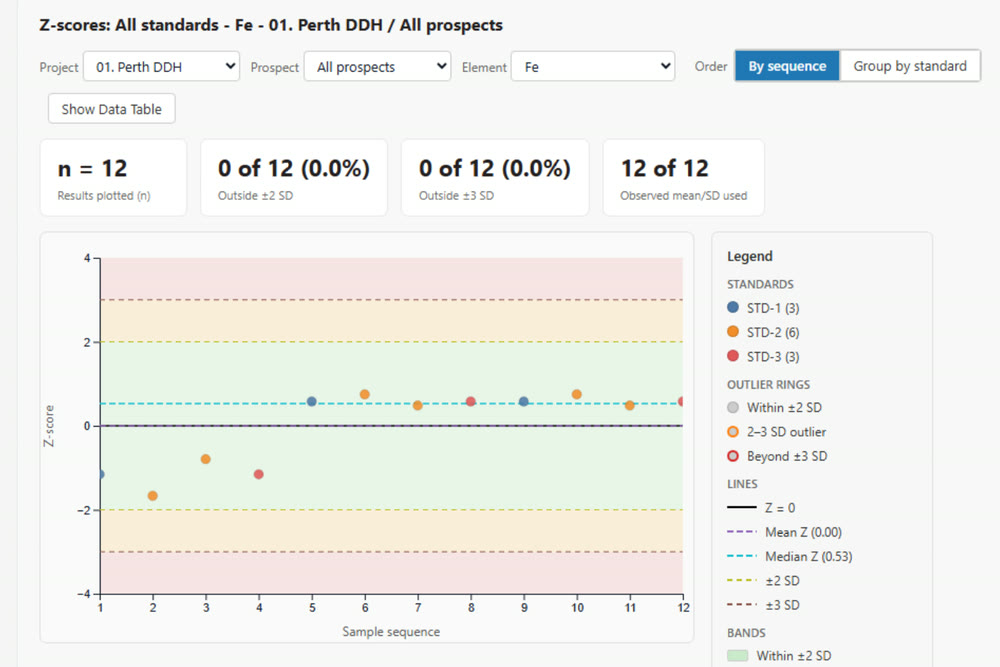
QA/QC · standards Z-score · demo dataset, real screen - 03
Compare holes side by side
Correlation between holes, to check an interval against its neighbours.
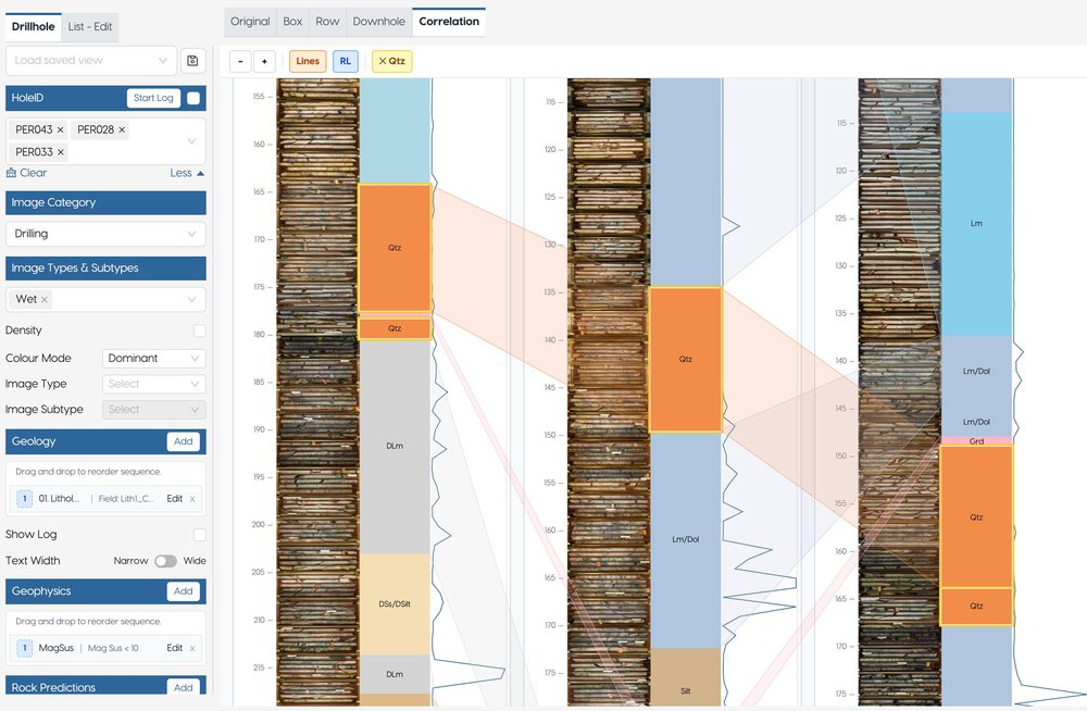
Correlation between holes · demo dataset, real screen - 04
Report from the same data
Dashboards and advanced reports built with MCPs on the validated dataset.
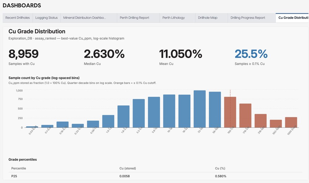
Cu grade dashboard (MCP) · demo dataset, real screen
Where it fits
View / Validate sits between logging and modelling: what is logged and assayed is checked here, so only validated data reaches the model.
Next steps
Request access and we’ll email your credentials, then set up your first project on a short onboarding call.