Features · Log
Log overview
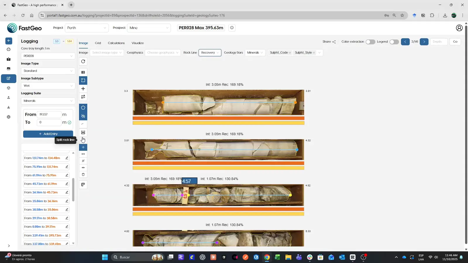
Core photos, sensor readings and nearby holes sit right beside the log, so every interval is logged in context, reviewed by the team, and feeds the assisted-logging models.

Overview
On many projects the log still lives on paper or in a spreadsheet, while the core photos, the sensor readings and the assays live somewhere else. They only meet weeks later, once the data has been transcribed, and by then the core is in its boxes.
FastGeo Log puts them on one screen. While you log an interval, its photos, its readings and the holes around it are right there, at the same depth. The team reviews the same record, and every validated interval helps train the assisted-logging models.
- Core and RC logging, online and offline
- Configurable fields with validation
- Photos and sensors in the same flow
- AI RQD and recovery
How it works
- 01
Open the hole
The downhole log sits beside its core photos and sensor readings, at the same depth, so every interval is logged in context.
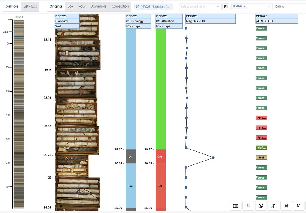
Downhole strip log · demo dataset, real screen - 02
Log each interval
Configurable fields with validation, for core and RC, online or offline. Photos and sensor readings come into the same flow.
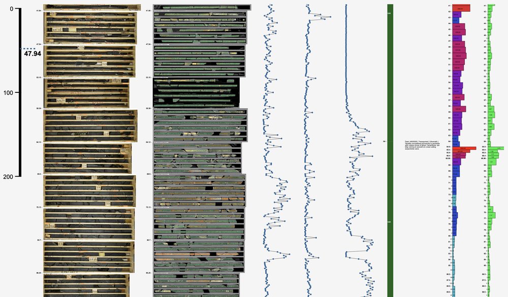
Core photos, LIBS and assays together · demo dataset, real screen - 03
Compare with the holes around it
Nearby holes side by side, so an interval can be checked against its neighbours.
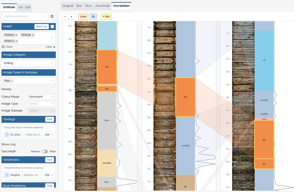
Correlation between holes · demo dataset, real screen - 04
Review, validate, train
The team reviews and validates the same record. Validated logs feed the assisted-logging models, such as AI RQD and recovery.
Where it fits
Log sits in the middle of the data flow, from the rig to the model: what Capture brings in is logged here, and every validated interval is ready to view, validate and model.
Next steps
Request access and we’ll email your credentials, then set up your first project on a short onboarding call.